GLAMi nomination: China at the Center
institution: Asian Art Museum
category: Exhibition Media or Experience
http://www.asianart.org/regular/china-at-the-center-interactive-displays
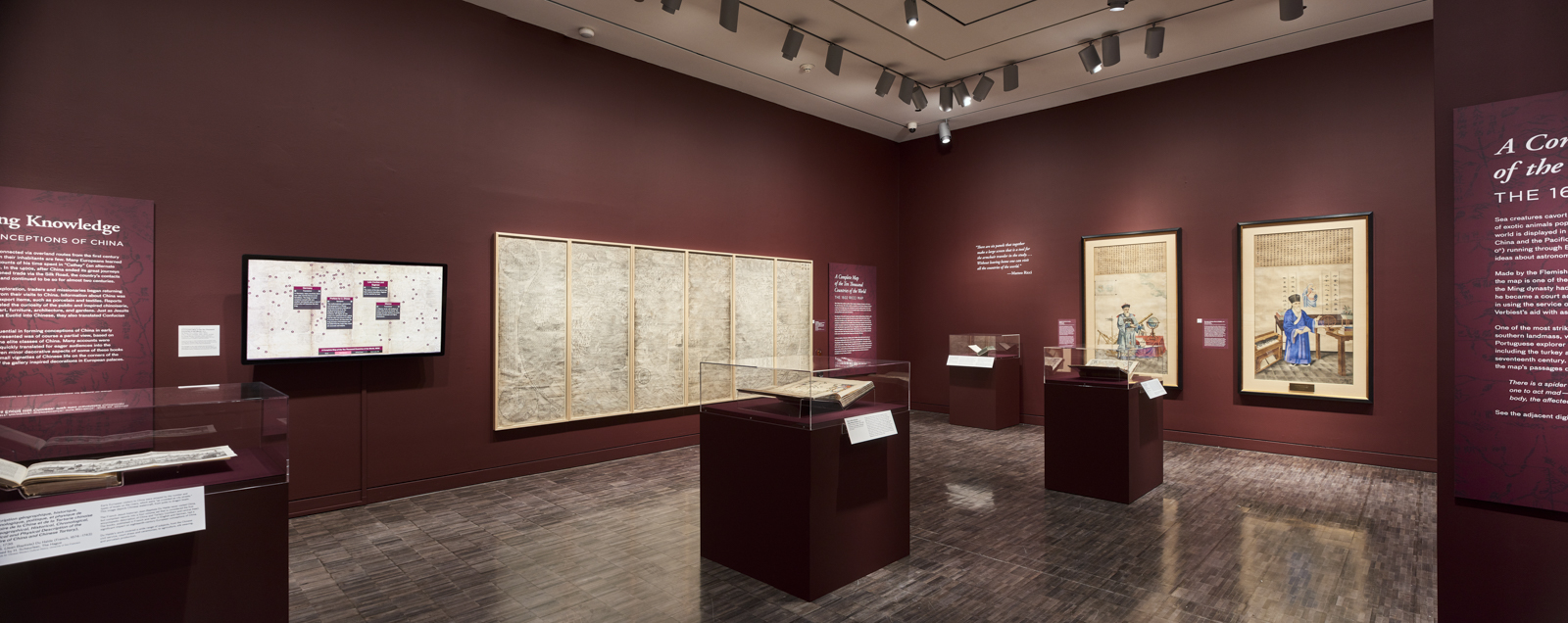
Travel back in time more than 400 years to an era when the globe was being mapped and its wonders discovered. The Asian Art Museum presented two rare masterpieces of 17th-century cartography, the result of collaborations between Jesuit priests and Chinese scholars sharing knowledge and curiosity about the world. A 1602 world map, developed by Matteo Ricci, and a 1674 map by Ferdinand Verbiest, were featured in the 2016 exhibition, China at the Center: Rare Ricci and Verbiest World Maps.
Both maps are covered in meticulous annotations written in classical Chinese, which provide intriguing details about distant lands and the people and creatures mapmakers believed inhabited them. The Verbiest map also features visual depictions of such creatures—from wolverines to unicorns. The annotations, inaccessible to those who do not read classical Chinese, were difficult to see on the large maps due to the height of the maps and the lighting and installation requirements of the exhibition. And if printed, the translations and commentaries would have resulted in many pages of text.
The museum therefore acquired high resolution photographs of the maps, commissioned new translations of both works, and partnered with Ideum to create two vibrant 55-inch interactive kiosks (one for each map) that provided multiple users at once random access to extensive English translations of the maps’ annotations. In some cases, the translations and depictions of creatures were supplemented with curator commentary. The Verbiest interactive also included related images, which mapmakers would have relied on to develop their own depictions of the creatures on the map, having never seen one in person.
Through an intuitive touchscreen interface adhering to universal design principles, users could move the maps and zoom in on details of areas of interest. The text on the interactives could also be enlarged and monitors were lowered after testing in order to further account for wheelchairs and people of short stature to increase accessibility.
The museum conducted a formal evaluation of the kiosks with visitors which revealed that the interactives enhanced the visitor experience. All interviewees reported an overall positive reaction. The primary reason why visitors stopped at the interactives was because they wanted to engage further with the maps by being able to look at them more closely and understand the translations. Visitors spent a long time with the interactives (average of 4.5 minutes). And the main value that visitors felt the interactives contributed to was their increased understandings of the maps. Visitors also cited that the experience was fun and hands-on. Comments included: “Wonderful. Made it more interesting since the original map is overwhelming.” “The original is so far away. I wanted to see it close-up.” “Allows better understanding of their knowledge of places. The descriptions & translation are all illuminating.”